
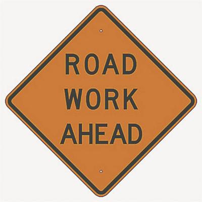
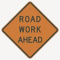
Motorists should take extra precautions when they’re driving on a stretch of Romaine Creek Road in unincorporated Fenton.
That 1-mile stretch of the road between Konert Road and Caleb Crossing was identified as the most dangerous mile in the county’s 730-mile system, according to a recently approved county Roadway Safety Master Plan.
The Public Works Department studied accidents in the county to develop the plan, but it does not include state roads like I-55, Hwy. 21 and Hwy. 30. It also doesn’t account for streets within city limits.
To come up with a list of the most dangerous stretches of county roads, Public Works Director Jason Jonas said he and his staff analyzed accident reports from July 1, 2014, through June 30, 2019, and plotted them on 1-mile segments of each county road. Measurements were weighted to account for injuries and fatalities as opposed to accidents that involved only property damage.
When all the numbers were crunched, 37 stretches of road stood out as needing attention, Jonas said.
Almost all the sites are north of the Hwy. M-Hwy. MM-Hwy. W corridor.
Seckman Road from Elephant Walk to the I-55 Outer Road near the Mastodon State Historic Site in Imperial, which ranked second most dangerous overall, was the most concerning in the northeast corner of the county.
In the south part of the county, the 1-mile section of Flucom Road between Kimberly and Orchard Park south of Festus and east of De Soto ranked highest on the list, at No. 17.
The Jefferson County Council agreed Aug. 9 to approve both the Roadway Safety Master Plan and the roadway Master Plan, which together detail problem areas in the county and outline ways to address them.
Jonas said both are intended as guidelines to set spending priorities for road improvements over the next five or six years.
Of the 37 dangerous roads identified in the plan, 17 already have been funded for safety improvements in the future.
“I think we’ve done a good job of identifying where we need to turn our attention to, but we still have 20 more to go,” Jonas said.
The last plans were drawn up in 2013 and adopted in 2014, and Jonas said the pandemic delayed updates until now.
He said Jefferson County is the second county in the state to complete a roadway safety master plan.
Jonas said when the data was completed, interesting trends came to light.
“We found that two-thirds of traffic crashes happen during the day, but three-fourths of the fatalities occur at night,” he said. “That tells me that the county needs a lighting intersection program. That really needs to be looked at.”
Of the 20 locations that are not yet funded for improvements, the study found that crashes into fixed objects, like utility poles or roads signs, are the most frequent (159 out of 518 accidents in the 20 stretches), and 144 (or 28 percent) happened on wet pavement, higher than the state average of 16 percent.
Jonas said looking ahead, priority would be placed on securing federal and state money to help with the 20 projects.
Beyond those 20 road segments, another 12 were identified in the plan as being “additional projects to consider.”
(See accompanying list of all 49 projects below.)
Jonas also said his department would look at replacing worn stop signs at the intersections of subdivision streets and county roads, and that in some areas, pavement markings need to be improved.
At a public hearing on the master plans held at the Aug. 9 meeting, Morgan Floyd of Imperial asked that her street, Rhonda Sue Drive, be placed on the list.
“Rhonda Sue Drive has a sharp corner at the bottom of a hill,” she said.
Floyd also said the road has been the site of several accidents.
Councilwoman Renee Reuter (District 2, Imperial), who lives on nearby Rhonda Sue Court, agreed, and called for Rhonda Sue Drive to be added to the list.
Jonas said a traffic study already is underway to come up with solutions for Rhonda Sue Drive, adding that his department already has placed signs advising motorists heading into the hill to slow their speed to 10 mph in that area, even though the posted speed limit for the road is 25 mph. He also said the county has placed additional chevron signs directing motorists through the area and installed an electronic sign advising drivers of their speed.
“Engineering solutions are only one part of the equation,” Jonas said. “There’s also enforcement, and I believe the Sheriff’s Office does its part with enforcement, and education also plays a part. I believe only one school district in the county offers traffic education. In the end, if people want to speed, they’ll speed. We’ve tried to educate them with the advisory signs, but there’s only so much we can do. I believe when the traffic study is complete, it will recommend solutions that will not give people a choice whether they want to speed.”
Jonas said many of the accidents on that stretch involve motorists running into signs on the side of the road, then correcting and returning to the road.
“They go their merry way and nothing is ever reported as far as an accident goes,” he said. “I’m an engineer. I can only analyze what data I am given, and if the accident isn’t reported, I can’t presume it happened. We know about the situation there, and that’s why we’ve ordered the traffic study.”
Reuter, who spoke as a member of the public rather than as a council member, was advised that she would have to abstain from voting on the roadway safety plan, and she did; it was approved 5-0. The roadway master plan was approved 6-0.
Council member Vicky James (District 7, Cedar Hill) was absent from the meeting.
Caution!
A Jefferson County Public Works Department study included in the 2021 Roadway Safety Master Plan identified these 1-mile sections of county roads as the most dangerous. Those projects that have been placed on a schedule for improvements with funding already secured are listed with an asterisk.
The second list includes sections for which safety improvements have not yet been funded; the third list includes sections that are considered additional projects to consider.
MOST DANGEROUS COUNTY ROADS
1. Romaine Creek from Konert to Caleb Crossing
2. Seckman Road from Elephant Walk to I-55 Outer Road*
3. Old Hwy. 21 and West Four Ridge Road intersection*
4. Saline Road from Willow Bend to Hermitage*
5. Konert Road from Breezy Oak to Konert Valley
6. Old Lemay Ferry Road between East Rock Creek Road and Spring Forest*
7. Old Hwy. 21 from Lonedell to Ench Forest
8. Old Sugar Creek Road from Sugar Creek to Anise
9. Miller and Vogel roads intersection
10. East Rock Creek Road from Ehlers to Old Lemay Ferry Road
11. Seckman Road from Old Lemay Ferry to Mastodon Drive*
12. Old Hwy. 21 from Hwy. 21 past Rock Creek Road
13. East Rock Creek and Gary roads intersection*
14. Brennan Road from Eagle to Little Brennan
15. Old Lemay Ferry Road from Miller to Brenda*
16. Gravois Road from Terrace to Roseglyn
17. Flucom Road from Orchard Park to Kimberly*
18. Antire Road from Brookside to Laurel
19. Old Hwy. M and Old Antonia Road intersection
20. Diehl-Saline from Old Sugar Creek to Walnut
21. High Ridge Boulevard and Capetown Village intersection
22. Antire Road from Pere Cliff to Williams Creek Road*
23. Lonedell Road from Valley to Jean
24. Twin River Road from Osage to Byrnes Mill*
25. Old Lemay Ferry Road between Frisco Hill and Regency Woods*
26. Old Hwy. M from Glenstone to Chasteen*
27. Saline Road from Chancellor to Romaine Creek Road
28. New Sugar Creek Road from Coil to Sugar Creek
29. Saline Road from Sunpark Spur to Silver Maple Drive*
30. Miller Road from Vogel Road to Corral Estates
31. Hunning Road and Cinphany Lane intersection*
32. Old Hwy. 21 and Glade Chapel-Goldman roads intersection
33. Old Hwy. 21 and Lions Den Road intersection*
34. Old Lemay Ferry Road from East Rock Creek to Lions Den
35. Old Hwy. 141 and Samarra Estates Drive intersection*
36. Antire Road and Crestview intersection*
37. Lonedell Road and Tomahawk intersection
UNFUNDED AREAS
1. Romaine Creek from Konert to Caleb Crossing
2. Konert Road from Breezy Oak to Konert Valley
3. Old Hwy. 21 from Lonedell to Ench Forest
4. Old Sugar Creek Road from Sugar Creek Road to Anise
5. Miller and Vogel road intersection
6. East Rock Creek Road from Ehlers to Old Lemay Ferry Road
7. Old Hwy. 21 from Hwy. 21 past Rock Creek
8. Brennan Road from Eagle to Little Brennan Road
9. Gravois Road from Terrace to Roseglyn
10. Antire Road from Brookside to Laurel
11. Old Hwy. M and Old Antonia Road intersection
12. Diehl-Saline from Old Sugar Creek Road to Walnut
13. High Ridge Boulevard and Capetown Village intersection
14. Lonedell Road from Valley to Jean
15. Saline Road from Chancellor to Romaine Creek
16. New Sugar Creek Road from Coil to Sugar Creek Road
17. Miller Road from Vogel to Corral Estates
18. Old Hwy. 21 and Glade Chapel-Goldman intersection
19. Old Lemay Ferry Road from East Rock Creek Road to Lions Den Road
20. Lonedell and Tomahawk intersection
ADDITIONAL PROJECTS TO CONSIDER
1. West Four Ridge from Matts Manor to Sparrow
2. Dulin Creek from Vinmill to Saxony
3. Lynch Road (curve in 4200 block)
4. Jarvis Road and Sandy Valley Road intersection
5. Cedar Hill Road from Local Hillsboro Road to White Oak Drive
6. Miller Road and Warren Road intersection
7. Victoria Glade Road and Hillsboro Victoria Road intersection
8. Upper Plattin Road (curve north of Frissel)
9. West Four Ridge Road from Old Hwy. 21 to Forest Lane
10. Old Hwy. 21 and Valley View Road intersection
11. Ems Road from Tower Road to east of Ems Crossing
12. West Rock Creek Road from West Swaller to Kreidheider