
The Jefferson County Council has approved the first countywide plan to improve pedestrian and cyclist accessibility.
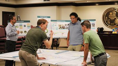
Employees from the Jefferson County Public Works Department, along with representatives from the Crawford, Murphy & Tilly Inc. and the SWT Design firms, make up what is called the Walk Bike Team and have worked since last April to create the plan. The team sought public feedback, held open houses to display drafts of the plan, and then presented the final 163-page document to the County Council on Feb. 24, which voted unanimously to approve it.
Public Works Director Jason Jonas said the Walk Bike Plan will be used to shape the county’s future walking and biking improvement projects. It also includes information about the current state of county corridors, specific routes highlighted for advancements and improvement cost breakdowns.
“It feels great (to have the plan approved),” Jonas said. “I expected it would go seamlessly because of the way we laid out the engagement process. The council was engaged throughout the whole process. I always felt like we had five or six council members who always knew what was going on.”
The plan includes proposed shared-use paths for pedestrians and cyclists, sidewalks connecting certain county features and roads best suited for bike routes.
The full plan can be accessed on the county website, jeffcomo.org/630/Walk-Bike-Jefferson-County-Master-Plan.
Proposed projects
The Walk Bike Team organized five focus groups to learn what biking and walking-related improvements the public would like to see included in the plan. The groups included seniors and people with disabilities, young people, business owners associated with tourism, civic leaders, and cyclists.
Several trends and overlapping needs emerged during the focus groups, and the team focused on those when developing the final plan, Jonas said.
Many in the groups called for expanded walking and biking access to the Mississippi River Trail along Hwy. 61-67 from Arnold to Festus, which Jonas called “the backbone” for future walking and biking paths to spring from.
“It’s going to take a lot of coordination with other agencies (to complete the proposed projects). We’re very eager to work with (the Missouri Department of Transportation) on the improvements of the (Mississippi River Trail) along Hwy. 61-67,” he said. “Without that good backbone, it becomes harder to get that connectivity that we’re really looking for in the plan.”
The final plan identifies more than 100 potential projects, with 10 selected as priority projects due to their estimated return on investment and key characteristics.
Some of the projects will be headed by municipalities, as the highlighted areas fall within city boundaries, Jonas said.
“I hope that this plan has given (municipalities) that road map, that public input, whether it’s feasible, and whether community wants it and will use it,” he said. “All of that groundwork will help them say, ‘Hey, they did all this work, and it sounds like this is where people would use the facility,’ because a lot of times with sidewalks and pedestrians, it’s hard to know what the usage might be.”
Jonas said the county Public Works Department will work to complete two or three of the projects listed in the plan every year, based on federal and local grant funding.
“Once you start chipping away at this, the improvements will happen rapidly a few years down the road,” he said.
Priority projects
■ A 1-mile-long sidewalk on New Sugar Creek Road in the Jefferson County portion of Fenton, connecting the existing St. Louis County sidewalk to Meadow Drive at an estimated cost of $1,198,827. According to the plan, the county is applying for a Transportation Alternatives Program grant this year to help pay for the project.
“It would be our first pedestrian connection to St. Louis County,” Jonas said.
■ A 7,700-foot-long sidewalk with on-road bike lanes along Truman Boulevard, from 11th Street to Veterans Boulevard in Festus, at an estimated cost of $2,788,000. According to the plan, that section of Truman Boulevard may require a “road diet,” or a reduction of travel lanes, to provide space for the sidewalks and bike lanes.
■ A 5,700-foot-long sidewalk with a signed bike route along West Main Street, from Festus Middle School to North Adams Street, costing an estimated $1,408,251. The project would require traffic-calming techniques through Main Street to reduce travel speeds, the plan states.
■ A 5,700-foot, multi-use path along Veterans Boulevard in Festus from Collins Drive to Truman Boulevard, with a short sidewalk included on Collins Drive, costing an estimated $1,309,000. The project would include improvements to the intersections at Bradley Street, Mill Street and Truman Boulevard.
■ A 2.4-mile, multi-use path along Jeffco Boulevard in Arnold from Arnold Tenbrook Road to Telegraph Road at an estimated cost of $2,992,927. Pedestrian crossings would be added at the Fox Pointe Parkway, Hazel Drive, Pleasant Valley Terrace and Richardson Road intersections, according to the plan.
■ A 7,300-foot, shared-use shoulder along Vogel Road in Arnold from Old Lemay Ferry Road to I-55, with a shorter sidewalk from the drive leading from the Home Depot store to the I-55 intersection. The project would cost approximately $599,075. The county was awarded a Safe Streets and Roads for All Planning and Demonstration Grant in 2024 that could be used to help fund the project, the plan states.
■ A 6,000-foot “bike facility” path on Jeffco Boulevard from Arnold City Park to Hwy. 141, including a short transition bike path and sidewalk along Bradley Beach Road to the city park, for an estimated cost of $390,000. Bike facilities are bike lanes made by allocating a section of the road strictly for bicyclists, or by building off-road paths.
■ A 2-mile, multi-use path called the Tenbrook Loop from the Fox schools campus on Jeffco Boulevard to the Arnold Tenbrook Road and Jeffco Boulevard intersection near the Club Car Wash, at an estimated cost of $1,804,041, according to the plan.
■ A 1.6-mile, multi-use path along the West Outer Road from Vogel Road in Arnold to Lakewood Landing in Imperial, costing about $977,000. The project includes a transition at the Miller Road intersection to allow for a future sidewalk connection from the West Outer Road to Miller Road.
■ A 2.65-mile, multi-use path along Hwy. 30 from Gravois Road to Hwy. BB in Cedar Hill at an estimated cost of $2,060,409, according to the plan.